


National Severe Storm Laboratory; NSSL Research: Flooding the Number One Hazardous Weather Killer In the US
FLOODING RESEARCH AREAS
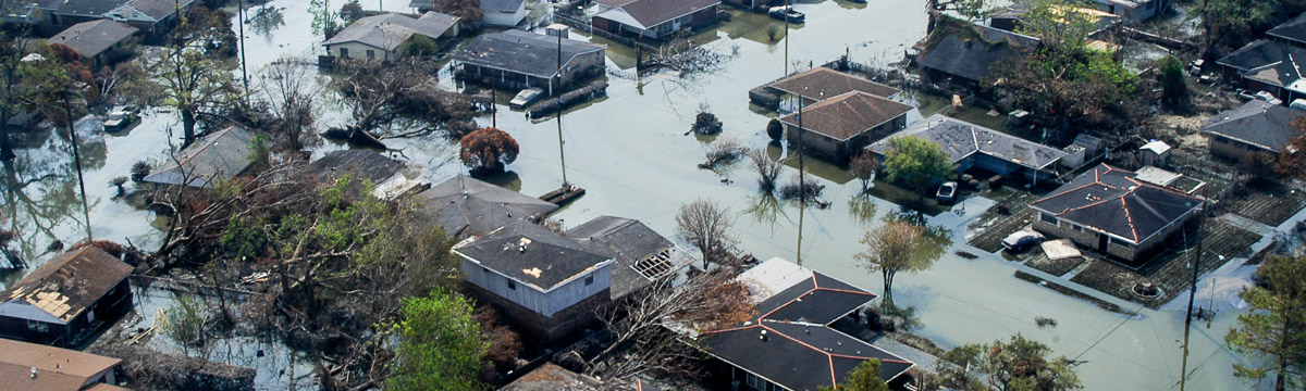
NSSL researchers investigate the meteorological causes of flash flooding and develop tools to improve the science and forecasting behind heavy rainfall and flash flooding.
Quantitative Precipitation Estimation (QPE): Multi-Radar Multi-Sensor (MRMS)
Following the success of the CRAFT—Collaborative Radar Acquisition Field Test—project, NSSL developed and implemented a real-time Multi-Radar Multi-Sensor system in 2004, integrating data from multiple radar networks, surface and upper air observations, lightning detection systems, satellite and numerical weather prediction models. The data is used to estimate and forecast precipitation locations, amounts, and types.
MRMS was transitioned into National Weather Service operations at the National Center for Environmental Prediction in 2014 and provides severe weather and precipitation products for improved decision-making capability within NOAA. The operational MRMS QPE products have high resolution and rapid-updating capabilities. The products are also used for verification of satellite rain products and for verification of quantitative rain forecasts from numerical weather prediction models. MRMS serves as a powerful tool for the creation and evaluation of new techniques, strategies and applications to improve QPE. As new concepts are developed, they can be tested within the real-time MRMS environment in the cloud. This process facilitates a rapid science-to-operations transition of new MRMS applications and products for flood and flash flood predictions and water resources management.
Flash flood modeling: Flooded Locations and Simulated Hydrographs (FLASH) project
The FLASH project was launched in early 2012 largely in response to the demonstration and real-time availability of high-resolution, accurate rainfall rate estimates from the Multi-Radar Multi-Sensor project. FLASH introduces a new paradigm in flash flood prediction, using MRMS and producing flash flood forecasts with products generated as frequently as every 2 minutes. FLASH represents the first continental-scale flash flood forecast system in the world, with hydrologic model forecasts being run every 10 minutes. FLASH has almost 11 million grid points across the country improving its forecast. The primary goal of FLASH is to improve accuracy, timing, specificity, and severity levels of flash flood warnings in the U.S., thus saving lives and protecting infrastructure. The FLASH team is comprised of researchers and students who use an interdisciplinary and collaborative approach to achieve the goal. The FLASH system was transitioned to the National Weather Service in November 2016.
More Articles
- National Institutes of Health: Common Misconceptions About Vitamins and Minerals
- Oppenheimer: July 28 UC Berkeley Panel Discussion Focuses On The Man Behind The Movie
- Julia Sneden Wrote: Love Your Library
- Scientific Energy Breakeven: Advancements in National Defense and the Future of Clean Power
- Center for Strategic and International Studies: “The Future Outlook with Dr. Anthony Fauci”
- Kaiser Health News Research Roundup: Pan-Coronavirus Vaccine; Long Covid; Supplemental Vitamin D; Cell Movement
- Indoor and Vertical Farming May Be Part of the Solution to Rising Demands for Food and Limited Natural Resources
- On Earth Day Find Your 'Local' Waterkeeper Organization; Biden's National Climate Task Force
- Even Though the Room Is Full, They Are “The Only One in the Room”; Eight Women Across 3 Centuries in Smithsonian Exhibit
- A New Dinosaur Study: Can We Really Tell Male and Female Dinosaurs Apart?